What Is a Kona Low and Why It Floods Hawaii
Kona lows are cold-core cyclones that reverse Hawaii's normal wind patterns, pushing moisture-laden air into the islands from the southwest and triggering severe flooding, landslides, and destructive surf.
A Storm That Flips Hawaii's Weather Upside Down
Hawaii's weather runs on a reliable engine: the trade winds, steady northeast breezes that push warm, moist air against the windward slopes of each island, delivering rain to one side and leaving the other dry. But several times each winter, a particular kind of storm rewrites the script. A Kona low parks itself west of the archipelago, reverses the winds, and drenches the normally arid leeward coasts with torrential rain. The name comes from the Hawaiian word kona, meaning leeward — the side that suddenly finds itself in the storm's crosshairs.
How a Kona Low Forms
The process starts thousands of metres above the Pacific. A deep dip — or trough — develops in the polar jet stream, the river of fast-moving air that steers mid-latitude weather systems. As the trough stretches southward toward the tropics, it can pinch off entirely from the main jet, leaving behind an isolated pocket of cold air aloft known as a cut-off low.
Once severed from the jet stream, the system stalls. Unlike typical mid-latitude storms that race across the ocean, a cut-off low drifts slowly, sometimes lingering near Hawaii for days or even a week. The counter-clockwise circulation around the low pulls warm, moisture-laden tropical air from the southwest directly into the islands, feeding intense and prolonged rainfall.
Meteorologists classify Kona lows as cold-core extratropical cyclones — distinct from warm-core hurricanes. They do not need tropical sea-surface temperatures to sustain themselves; their energy comes from the temperature contrast between cold upper-level air and warmer air below.
What Makes Them So Dangerous
Kona lows carry a broad menu of hazards:
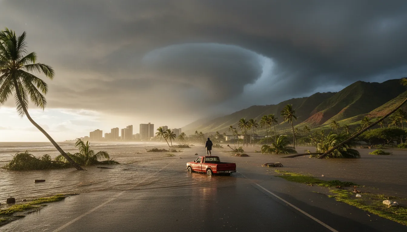
- Heavy rainfall and flash floods — the southwest wind flow forces moist air up mountain slopes that rarely see intense rain, overwhelming drainage infrastructure.
- High winds — gusts can exceed 100 mph at higher elevations, downing trees and power lines.
- Landslides and mudflows — saturated hillsides on the leeward side, unaccustomed to sustained rain, are especially vulnerable.
- Large surf and coastal flooding — south- and west-facing shores receive powerful swells generated by the storm's winds.
- High-elevation snow — the cold air aloft can bring snowfall to Mauna Kea and Mauna Loa summits.
The reversal of normal wind patterns is what makes the damage disproportionate. Communities built on the dry, leeward side — including much of Honolulu and popular resort areas — have storm-water systems designed for light showers, not multi-day deluges.
Frequency and Climate Trends
Hawaii typically experiences two to three Kona lows per season, mainly between October and April. However, a University of Hawaiʻi study examining 34 years of data found that the frequency of Kona low events has increased over recent decades, even as individual storms have grown shorter in duration.
Scientists are still investigating how climate change will reshape these storms. Warmer ocean surfaces supply more moisture, which can intensify rainfall. At the same time, shifts in the jet stream's average position may alter where and how often cut-off lows form near the islands. Hawaiʻi Public Radio reports that researchers are particularly interested in how Kona lows interact with atmospheric rivers — long plumes of tropical moisture — to produce extreme rainfall totals.
A Unique Vulnerability
Few places on Earth are as exposed to this specific type of weather reversal. Islands built around predictable trade-wind patterns face an asymmetric risk: the infrastructure, agriculture, and communities on the leeward side are designed for dry conditions. When a Kona low arrives, it tests systems that were never built for the load. Understanding how these storms form and behave is essential for forecasters, urban planners, and the millions who live in or visit the Hawaiian Islands each year.