Earthquake near Bratislava: Magnitude 4.6
A magnitude 4.6 earthquake struck near Šamorín, about 21 km from Bratislava, on Saturday. Thousands of people within a hundred-kilometer radius felt the tremors; rescue services reported no injuries or significant damage.
Strong Tremors Hit Southwestern Slovakia
One of the strongest earthquakes recorded in the region in recent years struck southwestern Slovakia on Saturday, February 21, 2026. According to preliminary measurements by the European-Mediterranean Seismological Centre (EMSC), the magnitude reached 4.6 — some agencies later corrected the value to 4.3. The tremors occurred at 1:44 PM local time and were felt by thousands of people across a large area of western Slovakia.
Epicenter near Šamorín, Depth around 10 km
The epicenter was located near the village of Kyselica in the Dunajská Streda district, approximately 7.5 kilometers southeast of Šamorín and about 21 kilometers from the center of Bratislava. The focus was at a depth of around ten kilometers — a so-called shallow earthquake, where the tremors are more intense on the surface. This is why the shaking affected a large area: residents of Bratislava, Trnava, Senec, Nové Zámky, and Trenčín reported feeling the tremors. According to measurements from several seismological networks, the earthquake was felt within a radius of 50 to 100 kilometers from the epicenter, and over 4,400 people completed online questionnaires about their experiences.
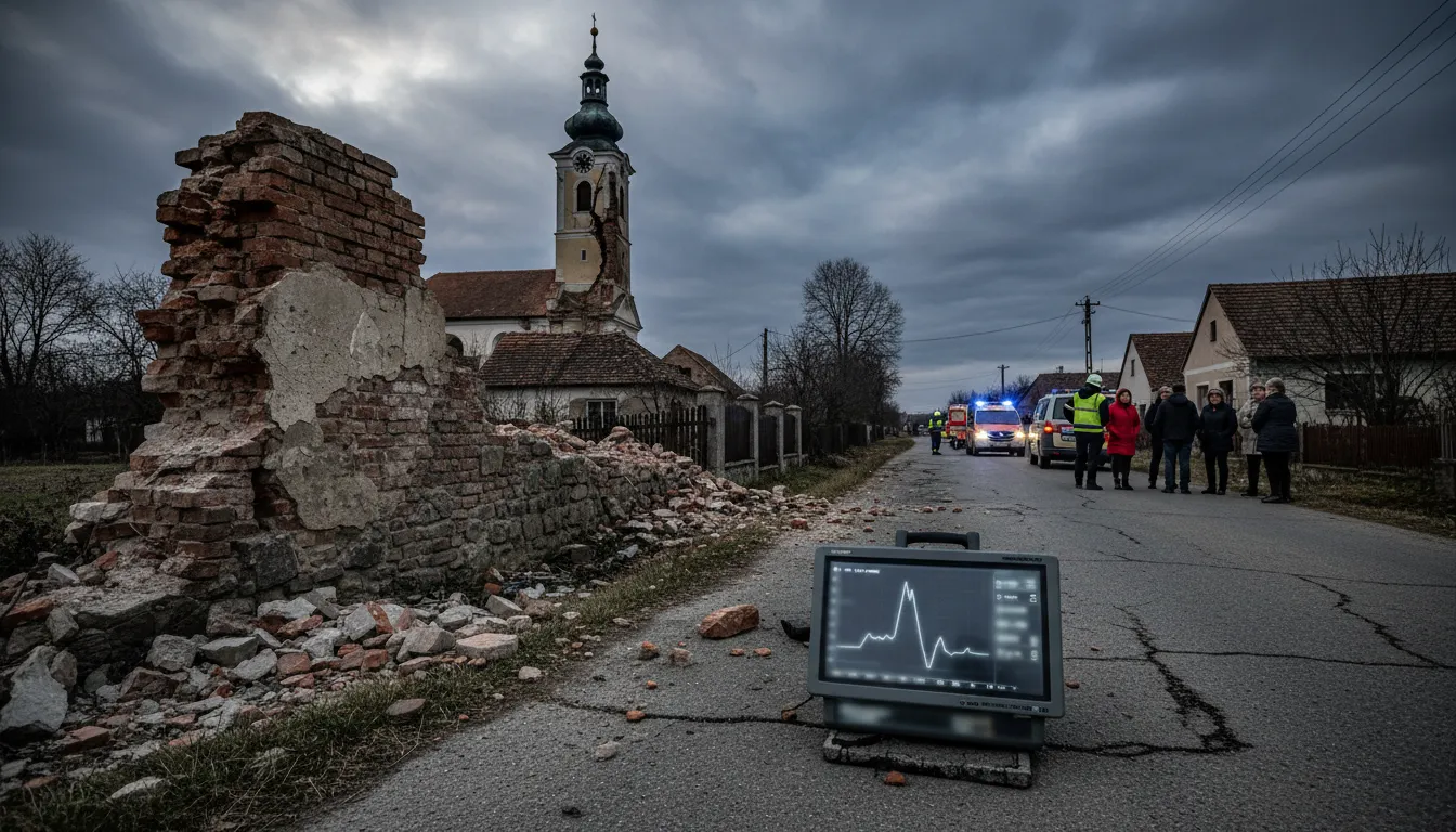
Damage and Response of Rescue Services
Residents of Šamorín described a feeling of strong rumbling accompanied by several seconds of shaking buildings and moving furniture. Cracked plaster, cracks in the facades of houses, and damage to the foundations of one dwelling near Šamorín were reported. Rescue services checked the situation in the Bratislava, Trnava, and Nitra regions. The Ministry of Interior of the Slovak Republic confirmed no injuries or significant material damage. The Gabčíkovo dam underwent an immediate safety inspection — operators confirmed its full functionality without any damage.
Series of Aftershocks Continued into the Evening
After the main tremor, Slovak and Hungarian seismic stations recorded a series of aftershocks. The Hungarian observatory Kövesligethy Radó confirmed tremors with a magnitude of 1.7 to 1.8; a more significant aftershock with a value of 2.5 was recorded at 6:44 PM in the area between Báč and Šamorín, and an aftershock with a magnitude of 2.6 followed at 9:17 PM. Kristián Csicsay, head of the seismological department of the Slovak Academy of Sciences, stated: "After earthquakes with a magnitude of around 4, weaker aftershocks are relatively common, especially in the first hours or days." He assesses the probability of a strong subsequent tremor as minimal — any further movements will only be detectable by instruments.
Pannonian Fault: Geology of Southwestern Slovakia
Southwestern Slovakia lies on the geotectonic boundary of the Little Carpathians and the Vienna Basin, in the zone of the Pannonian Fault running through the entire Carpathian Basin. It is here that tension accumulates long-term in the Earth's crust, which is periodically released in the form of seismic events. Earthquakes with a magnitude above 4 are less frequent in this region, but not unprecedented — historical records show similar events in the past. The seismic network of the SAS continues to monitor the situation; experts recommend that residents report any new cracks in buildings to the relevant municipal authorities.