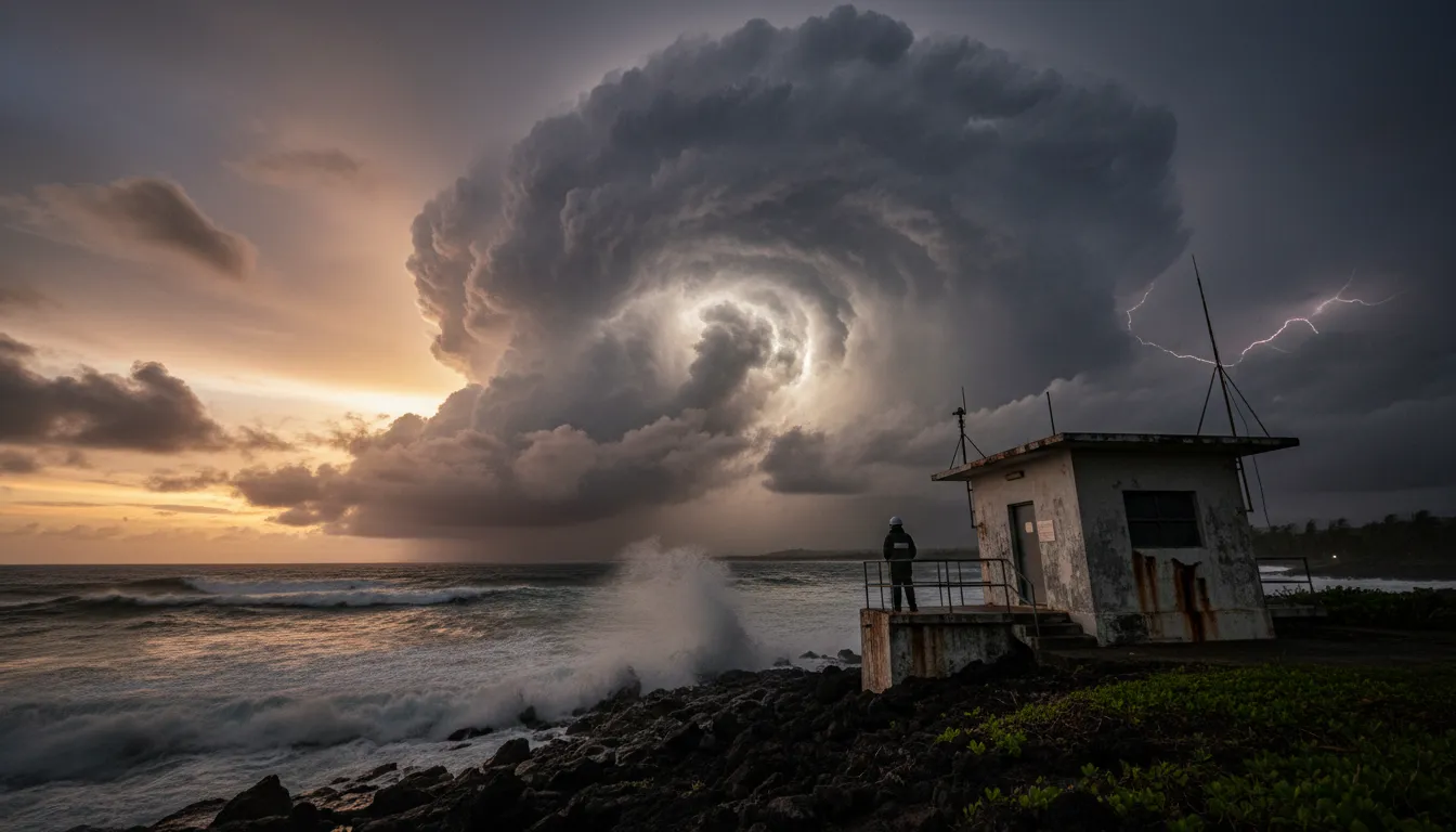
How Super Typhoons Form—and Why They Intensify
Super typhoons are the most powerful storms on Earth, with winds exceeding 150 mph. Here's how they form, why they intensify so rapidly, and what makes the western Pacific their breeding ground.
What Is a Super Typhoon?
Tropical cyclones go by different names depending on where they spin—hurricanes in the Atlantic, cyclones in the Indian Ocean, and typhoons in the western Pacific. A super typhoon sits at the top of that intensity ladder. The U.S. Joint Typhoon Warning Center (JTWC) classifies any typhoon with sustained winds of at least 150 mph (130 knots) as a super typhoon, roughly equivalent to a high-end Category 4 or Category 5 storm on the Saffir-Simpson scale used for Atlantic hurricanes.
Super typhoons are overwhelmingly a western Pacific phenomenon. The basin's vast expanse of warm water—often exceeding 29 °C (84 °F)—provides the fuel these storms need to reach extreme intensity. No other ocean basin produces as many violent tropical cyclones each year.
How They Form
Every super typhoon starts the same way: as a disorganized cluster of thunderstorms over warm tropical ocean. According to NOAA's Atlantic Oceanographic and Meteorological Laboratory, several ingredients must align for that cluster to organize into a tropical cyclone:
- Warm sea surface temperatures of at least 26–27 °C (79–81 °F) down to a depth of roughly 50 metres, providing the heat energy that powers evaporation and rising air.
- Low vertical wind shear—less than about 10 m/s between the surface and the upper atmosphere—so that the developing storm column is not torn apart.
- Sufficient distance from the equator (typically at least 5° latitude) so the Coriolis effect can set the system spinning.
- Pre-existing atmospheric disturbance with enough rotation and moisture convergence to trigger sustained convection.
When these conditions align, warm moist air spirals inward and rises rapidly, releasing latent heat as water vapor condenses. That heat warms the column further, lowering surface pressure and drawing in yet more air—a self-reinforcing engine that can spin up from tropical storm to super typhoon in days.
Rapid Intensification: From Storm to Monster
The most dangerous feature of super typhoons is rapid intensification—defined as a wind-speed increase of at least 35 mph in 24 hours. A 2023 study published in Nature Communications found that the frequency of rapid intensification events has been rising globally since the early 1980s, driven by warming ocean surfaces.
NOAA's Geophysical Fluid Dynamics Laboratory reports that climate change is "likely fueling more powerful tropical cyclones" and that the proportion of storms undergoing rapid intensification in the Atlantic nearly doubled between 1982 and 2009. The same physics applies across basins: warmer water means more available energy, and deeper pools of warm water mean storms can churn without pulling up cold water that would otherwise slow them down.
Perhaps most alarmingly, rapid intensification is increasingly happening closer to coastlines. Research shows the frequency of rapid intensification within 400 km of land tripled between 1980 and 2020, leaving less warning time for evacuations.
Why the Western Pacific Breeds the Strongest Storms
The western Pacific consistently produces the planet's most intense tropical cyclones for several reasons. The basin has the warmest and deepest pool of tropical ocean water on Earth, stretching across thousands of kilometres. It also features favourable atmospheric circulation patterns and relatively low average wind shear during peak typhoon months.
Historical records reflect this dominance. Typhoon Tip in 1979 remains the most intense tropical cyclone ever measured, with a central pressure of 870 mb. Typhoon Haiyan in 2013 struck the Philippines with 195 mph winds, killing more than 6,300 people and causing an estimated $13 billion in damage. Its 5-metre storm surge in Tacloban devastated entire coastal communities.
What Makes Them So Destructive
Super typhoons inflict damage through three main mechanisms. Extreme winds flatten structures and turn debris into projectiles. Storm surge—a wall of ocean water pushed ashore by wind—is often the deadliest component, capable of inundating low-lying areas under metres of water. Torrential rainfall, sometimes exceeding 500 mm in 24 hours, triggers catastrophic flooding and landslides long after the wind subsides.
The combination of these hazards makes super typhoons especially lethal in densely populated coastal areas across the Philippines, southern Japan, Taiwan, Vietnam, and China—regions where tens of millions live in vulnerable communities near the shore.
Looking Ahead
Climate models project that while the total number of tropical cyclones may not increase, the proportion reaching the highest intensities almost certainly will. As ocean temperatures continue to rise, the conditions that breed super typhoons are becoming more common and lasting longer into the year. Understanding how these storms form and intensify is not just academic—it is essential for the hundreds of millions of people who live in their path.