How Deep-Sea Aircraft Searches Work
When a plane vanishes over open ocean, finding it can mean scanning thousands of square kilometers of pitch-black seafloor miles beneath the surface. Here is how the technology and science behind deep-ocean aircraft searches actually work.
A Problem Unlike Any Other
When a commercial aircraft disappears over the open ocean, the challenge of finding it dwarfs almost any other search-and-rescue operation in human history. The southern Indian Ocean — where Malaysia Airlines Flight MH370 is believed to have crashed in March 2014 — reaches depths of up to 4,000 meters, spans millions of square kilometers, and is among the most remote and poorly mapped regions on Earth. More than a decade later, teams using the most advanced marine robotics available have still not located the main wreckage, illustrating just how formidable the task truly is.
The First Race: Finding the Black Box Beacon
Every commercial aircraft carries two flight recorders — a Flight Data Recorder (FDR) and a Cockpit Voice Recorder (CVR), colloquially known as "black boxes." Attached to each is an Underwater Locator Beacon (ULB): a small device that activates automatically on contact with water and begins emitting a 37.5 kHz ultrasonic pulse once per second.
According to SKYbrary, these beacons are rated to operate at depths of up to 6,000 meters and are designed to ping for at least 30 days. Search vessels drag towed pinger locators (TPLs) — hydrophone arrays — through the water to pick up the signal. The catch: in depths greater than about 2 kilometers, the 37.5 kHz signal attenuates rapidly and typically cannot be detected from the surface. Ships must get close — sometimes within 1–2 kilometers — to hear it.
If the beacon is not found within 30 days, or if the search area is too vast, teams must shift to a slower, more systematic approach: mapping the seafloor itself.
Sonar: Seeing Without Light
Below a few hundred meters, sunlight does not penetrate. Finding wreckage requires acoustic imaging — using sound waves the way bats use echolocation. There are two primary sonar tools used in deep-ocean searches.
Side-scan sonar emits fan-shaped pulses of sound to each side of a vehicle and measures the intensity of returning echoes. Hard objects reflect more sound; soft sediment absorbs it. The result is a grayscale image of the seafloor that reveals unusual shapes, anomalies, and debris fields. As NOAA Ocean Exploration explains, the technique is similar to shining a flashlight sideways across a surface — objects cast acoustic "shadows" that help analysts identify them.
Synthetic Aperture Sonar (SAS) is a more sophisticated method. Rather than relying on a single ping, it combines multiple overlapping returns as the vehicle moves forward, generating far sharper images than conventional side-scan. This makes it possible to detect smaller objects and distinguish wreckage from natural features on the ocean floor.
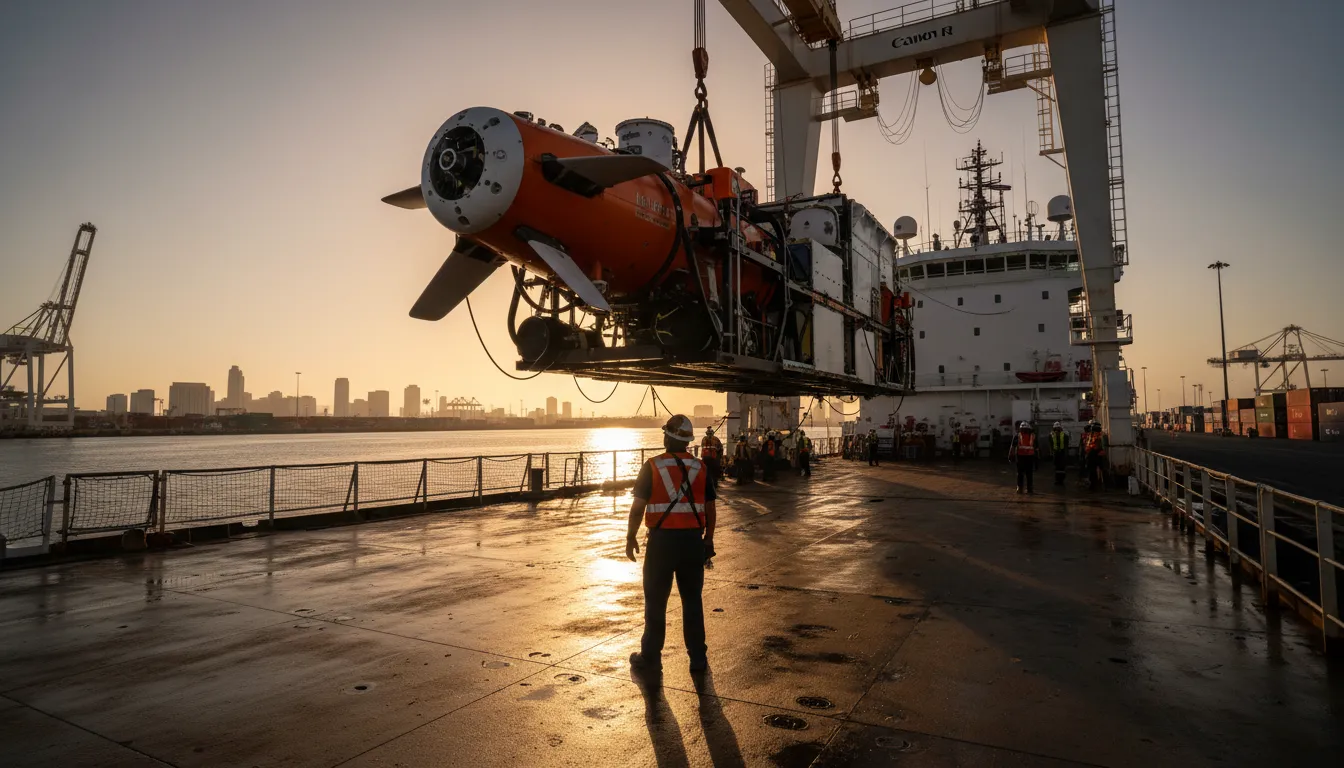
Autonomous Underwater Vehicles: The Workhorses
Hull-mounted ship sonar sends signals from the surface down to depths of several kilometers, but the resulting resolution is coarse — each image pixel can represent an area the size of a football field. To achieve the detail needed to identify aircraft debris, searchers deploy Autonomous Underwater Vehicles (AUVs), which operate just tens of meters above the seafloor, where sonar resolution improves dramatically.
In the renewed MH370 search, Texas-based marine robotics firm Ocean Infinity deployed its Armada fleet — lean, semi-autonomous surface vessels that launch and recover swarms of AUVs through moonpools in the hull. According to Scientific American, these AUVs can spend up to four days submerged, mapping the seafloor at depths approaching 6,000 meters with multibeam sonar, sub-bottom profilers to see beneath sediment, and magnetometers to detect metallic wreckage. The ability to run multiple AUVs simultaneously dramatically increases coverage rates compared to earlier single-vehicle missions.
Why the Ocean Wins — for Now
Even with cutting-edge technology, deep-ocean searches face hard physical limits. The southern Indian Ocean is vast: Ocean Infinity covered roughly 140,000 square kilometers since 2018 and has yet to find MH370's main debris field, according to NPR. Each search campaign depends on a best-estimate crash location derived from satellite communications data — an imprecise science. A small error in the estimated flight path can translate into hundreds of kilometers of offset on the seafloor.
Deep-sea currents also scatter debris over time, and thick layers of marine sediment can bury wreckage entirely — making even the best sonar images ambiguous. Data analysis itself is labor-intensive: PBS NewsHour reports that analysts must review thousands of sonar images for anomalies, a process increasingly aided by machine learning but still far from automated.
A Field Being Transformed
The long hunt for MH370 has accelerated innovation in marine search technology. AUVs are now faster, dive deeper, and carry richer sensor payloads than ever before. Researchers at MIT are developing surface-vehicle sonar arrays that could map vast areas without deploying underwater robots at all. The tragedy, while unresolved, has made the deep ocean fractionally less unknowable — and the next search a little more likely to succeed.