How Tornadoes Form—and Why the U.S. Gets the Most
An explainer on the atmospheric mechanics behind tornado formation, why the United States experiences more tornadoes than any other country, and how meteorologists detect and warn communities before twisters strike.
A Violent Meeting of Air Masses
A tornado is a narrow, violently rotating column of air that extends from a thunderstorm cloud to the ground. Though they can occur on every continent except Antarctica, the United States experiences roughly 1,200 tornadoes per year—more than any other country on Earth. Understanding how these destructive vortices form begins with the atmosphere itself.
The Ingredients for a Tornado
Tornadoes require three key atmospheric ingredients: instability, moisture, and wind shear. Instability occurs when warm, humid air near the surface sits beneath cooler, drier air aloft—creating conditions where rising air accelerates upward. Moisture, typically drawn from the Gulf of Mexico in the U.S., fuels powerful thunderstorms. Wind shear—winds blowing at different speeds or directions at different altitudes—sets the air spinning horizontally.
According to the NOAA National Severe Storms Laboratory, the strongest tornadoes emerge from supercell thunderstorms, massive rotating storms that can persist for hours. Inside a supercell, the horizontal spin gets tilted vertical by the storm's powerful updraft, creating a rotating column called a mesocyclone.
But a mesocyclone alone does not guarantee a tornado. Scientists at Penn State University explain that a second process must occur near the ground: outflow from the storm's downdraft creates horizontal rotation at the surface, which the updraft then stretches upward. When this tightening vortex reaches the ground, a tornado is born.
Why Tornado Alley Exists
The central United States—often called Tornado Alley—stretches roughly from central Texas northward through Oklahoma, Kansas, and Nebraska into the Dakotas. This region's unique geography makes it the world's prime tornado breeding ground.
Three air masses regularly collide here: cold, dry air sweeping south from Canada; warm, moist air flowing north from the Gulf of Mexico; and dry air pushing east from the Rocky Mountains. The flat, expansive terrain offers no natural barriers to slow these clashing systems, according to Britannica. The result is explosive atmospheric instability during spring and early summer.
However, researchers increasingly note that tornado activity is shifting eastward into the Southeast—sometimes called "Dixie Alley"—where tornadoes are particularly dangerous because they are more likely to occur at night and in forested terrain that limits visibility.
Rating the Damage: The Enhanced Fujita Scale
Tornadoes are rated after the fact using the Enhanced Fujita (EF) Scale, which replaced the original Fujita Scale in 2007. Trained National Weather Service personnel survey damage and compare it against 28 standardized Damage Indicators—ranging from mobile homes to shopping malls—each with specific Degrees of Damage.
The scale runs from EF0 (winds of 65–85 mph, light damage) to EF5 (winds exceeding 200 mph, total destruction). Critically, the rating reflects damage observed, not wind speed measured directly—making construction quality a key variable in the assessment.
How Forecasters Sound the Alarm
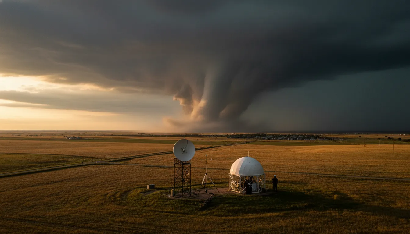
Modern tornado detection relies on Doppler radar, which can identify rotation inside a thunderstorm before a tornado touches down. Dual-polarization radar, now standard on NWS systems, detects debris lofted by a tornado—leaves, insulation, building materials—giving forecasters high confidence a twister is on the ground, even at night.
The process works in stages. The Storm Prediction Center issues watches when atmospheric conditions favor tornado development, typically covering four to six hours. Local NWS offices then issue warnings when a tornado is detected on radar or spotted visually. Average warning lead time is roughly 13 minutes—enough time to seek shelter, but not to evacuate.
NOAA's next-generation Warn-on-Forecast program aims to extend lead times by issuing warnings based on computer model forecasts rather than waiting for radar confirmation—a shift that could save lives in fast-developing storms.
A Phenomenon Still Full of Mysteries
Despite decades of research, scientists still cannot predict exactly which supercells will produce tornadoes and which will not. The final trigger—what tips a rotating storm into spawning a ground-level vortex—remains one of atmospheric science's most stubborn questions. Until that puzzle is solved, the combination of radar technology, trained storm spotters, and public preparedness remains the best defense against nature's most violent windstorms.