What Is the Antonine Wall—Rome's Forgotten Frontier
The Antonine Wall, a turf fortification stretching 60 kilometers across Scotland, marked the Roman Empire's northernmost boundary. A UNESCO World Heritage Site, it reveals how Rome defended and ultimately abandoned its most ambitious British frontier.
Rome's Northernmost Border
Most people have heard of Hadrian's Wall, the famous stone barrier across northern England. Far fewer know about its lesser-known sibling 160 kilometers to the north: the Antonine Wall, a turf-and-timber fortification that once stretched across Scotland's narrow waist. For a brief period in the second century AD, this earthen rampart marked the absolute northern limit of the Roman Empire — the point beyond which Rome could not push.
Inscribed as a UNESCO World Heritage Site in 2008, the Antonine Wall remains one of Europe's most significant yet underappreciated Roman monuments. Recent archaeological discoveries, including a previously unknown fortlet found beneath suburban gardens in Bearsden near Glasgow, continue to reshape understanding of this frontier.
Why the Romans Built a Second Wall
Emperor Antoninus Pius ordered the wall's construction around AD 142, roughly two decades after Hadrian's Wall was completed. The project was led by governor Quintus Lollius Urbicus and took an estimated six years to finish. Historians believe Antoninus wanted a military triumph to legitimize his rule — pushing Rome's frontier northward into Caledonian territory served that political purpose.
The wall ran approximately 60 kilometers from Bo'ness on the Firth of Forth in the east to Old Kilpatrick on the River Clyde in the west. Unlike Hadrian's stone wall, the Antonine Wall was built from turf blocks stacked on a stone foundation, standing about three meters high and five meters wide. A deep, wide ditch ran along its northern face, and a military road — the Military Way — connected the forts behind it.
A Dense Network of Forts
What the Antonine Wall lacked in height it made up for in density of fortifications. The Romans originally planned forts every 10 kilometers, but quickly revised the interval to roughly every 3.3 kilometers, resulting in at least 16 to 19 forts with smaller fortlets in between. This spacing was far tighter than along Hadrian's Wall, suggesting the frontier was more volatile and required closer surveillance.
Each fort housed infantry or cavalry units that controlled movement across the border. The Bearsden fort, discovered during construction work in 1973, yielded one of the best-preserved Roman bathhouses in Scotland. Analysis of sewage from the fort's latrine revealed details about soldiers' diets — largely grain-based, with little evidence of meat — offering an intimate window into daily frontier life.
Abandoned in a Generation
Despite the enormous effort required to build it, the Antonine Wall was occupied for only about 20 years. By the AD 160s, under Emperor Marcus Aurelius, Rome pulled its garrisons back to Hadrian's Wall. The reasons remain debated: pressure from Caledonian tribes to the north, logistical difficulties in supplying such a remote frontier, and shifting imperial priorities all likely played roles.
The abandonment underscores a recurring theme in Roman history — the tension between imperial ambition and the practical limits of holding territory. The Antonine Wall represents Rome's most aggressive attempt to dominate Britain, and its swift withdrawal illustrates why empires struggle to hold overextended borders.
What Remains Today
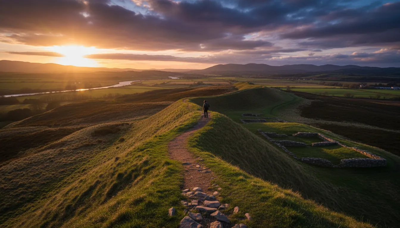
Because it was built from turf rather than stone, much of the Antonine Wall has eroded over nearly two millennia. Yet about one-third of the wall remains visible as a series of earthworks, ditches, and fort foundations. Sections at Rough Castle, Watling Lodge, and Bearsden offer the clearest views of the surviving remains.
Archaeology continues to add new chapters. In research published in 2026, GUARD Archaeology reported the discovery of a previously unknown fortlet beneath back gardens in Bearsden, strategically positioned with direct sightlines to the larger fort nearby. Radiocarbon dating of timbers from the site's ditch placed them firmly within the wall's active period, confirming this was part of Rome's integrated defense network.
For visitors, historians, and archaeologists alike, the Antonine Wall serves as a powerful reminder: even the mightiest empires have limits, and sometimes those limits are written in turf and earth rather than stone.