Giant Granite Mass Found Beneath Antarctica's Ice
Scientists discovered a 100-kilometer-wide granite body buried beneath Pine Island Glacier by tracing pink boulders on Antarctica's Hudson Mountains, a finding that could reshape predictions of sea level rise.
Pink Boulders Unlock a Jurassic Secret
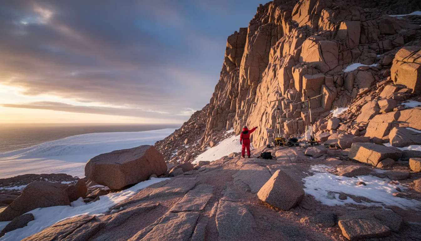
Pink granite boulders scattered among dark volcanic rocks atop Antarctica's Hudson Mountains have led scientists to a remarkable discovery: a hidden granite mass stretching nearly 100 kilometers wide and 7 kilometers thick buried beneath Pine Island Glacier — one of the fastest-retreating glaciers on Earth.
The finding, published in Communications Earth & Environment by researchers at the British Antarctic Survey (BAS), rewrites what scientists know about the bedrock beneath West Antarctica and carries significant implications for predictions of future sea level rise.
How Scientists Found the Hidden Giant
The discovery began with a geological puzzle. During field surveys conducted as part of the International Thwaites Glacier Collaboration, researchers noticed distinctly pink granite boulders sitting among otherwise dark volcanic terrain in the Hudson Mountains. These boulders had no obvious local source.
Lead author Dr. Tom Jordan, a geophysicist at BAS, and geologist Dr. Joanne Johnson used radioactive decay analysis of microscopic mineral crystals to date the granites to approximately 175 million years ago — the Jurassic period, when dinosaurs roamed the planet.
The critical breakthrough came when the team cross-referenced these geological findings with airborne gravity measurements collected by BAS Twin Otter aircraft. The gravity data revealed an unmistakable signature beneath the ice: a massive granite body roughly half the size of Wales.
"It's remarkable that pink granite boulders spotted on the surface have led us to a hidden giant beneath the ice," said Dr. Jordan.
A Window Into the Last Ice Age
The boulders themselves tell a story of dramatically different ice conditions. During the last ice age roughly 20,000 years ago, Pine Island Glacier was far thicker and more powerful than today. The ice gouged rocks from the granite foundation below and carried them uphill, depositing them on the Hudson Mountains as the glacier later thinned. Each boulder serves as a marker of where the glacier once reached.
"Rocks provide an amazing record of how our planet has changed over time, especially how ice has eroded and altered the landscape," noted Dr. Johnson.
Why It Matters for Sea Level Rise
Pine Island Glacier has experienced some of the fastest ice loss in Antarctica in recent decades. Its complete collapse could contribute more than 50 centimeters to global sea level rise, threatening coastal communities worldwide.
The type of rock beneath a glacier fundamentally influences how ice moves. Granite bedrock affects how easily ice slides over its base and how subglacial meltwater — a key driver of glacier acceleration — flows underneath. Previous research has also identified volcanic heat sources in the Pine Island region supplying geothermal energy at a rate of approximately 2,500 megawatts, enough to accelerate basal melting.
The newly mapped granite body adds another layer of complexity. By understanding the subglacial geology, scientists can refine the computer models used to forecast how West Antarctica's ice sheet will respond to warming oceans and rising atmospheric temperatures in the decades ahead.
Rewriting the Map of Antarctica
The study demonstrates the power of combining traditional geological fieldwork with modern geophysical techniques. Much of Antarctica's bedrock remains poorly understood, hidden beneath kilometers of ice. Discoveries like this one help fill critical gaps in geological maps that underpin climate projections.
As the planet warms and ice sheets face increasing stress, knowing what lies beneath the ice is no longer just a geological curiosity — it is essential for anticipating the pace and scale of sea level rise that billions of coastal residents may face this century.