How Tornadoes Form and Why They're So Destructive
Tornadoes are among the most violent weather phenomena on Earth. Here is the science behind how they develop from ordinary thunderstorms into spinning columns of destruction — and why the United States sees more of them than anywhere else.
What Is a Tornado?
A tornado is a rapidly rotating column of air that extends from a thunderstorm cloud to the ground. Wind speeds inside the most powerful examples can exceed 200 miles per hour (320 km/h), making them capable of demolishing buildings, uprooting trees, and hurling cars hundreds of metres. The United States experiences roughly 1,000 to 1,200 tornadoes per year — more than any other country — causing an average of 70 deaths and 1,500 injuries annually, according to the National Oceanic and Atmospheric Administration (NOAA).
The Ingredients for a Tornado
Tornadoes do not appear out of nowhere. They require a very specific set of atmospheric conditions, most commonly found when three distinct air masses collide:
- Warm, moist air streaming northward from the Gulf of Mexico
- Cold, dry air pushing down from Canada
- Jet-stream winds high in the atmosphere that create wind shear
Wind shear — the change in wind speed or direction with altitude — is the critical ingredient. When surface winds blow from the south-east while upper-level winds blow from the south-west at a much higher speed, the invisible layers of air between them begin to roll horizontally, like a pencil spinning between two hands. A vigorous thunderstorm updraft can then tilt this rolling air column vertically, creating a rotating structure known as a mesocyclone.
From Thunderstorm to Supercell
Not every thunderstorm produces a tornado. The most tornado-prone storms are called supercells — large, long-lived thunderstorms with a persistent rotating updraft at their core. According to the National Severe Storms Laboratory (NSSL), only about 30 percent of supercells ever produce a tornado, but virtually all supercells generate some form of severe weather, whether large hail, damaging winds, or intense rainfall.
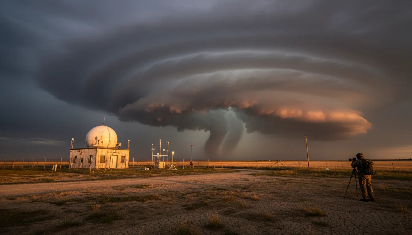
Tornado formation inside a supercell follows a three-stage sequence. First, the rotating updraft (the mesocyclone) intensifies at mid-levels of the storm. Second, a tighter, narrower vortex begins to extend downward toward the surface. Third, when the descending funnel makes contact with the ground — confirmed by swirling debris — it officially becomes a tornado. This entire process can unfold in minutes.
The EF Scale: Measuring Destruction
After a tornado, scientists rate its intensity using the Enhanced Fujita (EF) Scale, which replaced the original Fujita scale in 2007. The rating is based not on direct wind measurements — instruments rarely survive a tornado's direct hit — but on the pattern and severity of damage left behind. Engineers and meteorologists survey structures, trees, and vehicles, then cross-reference the damage against a standardised set of 28 damage indicators.
| Category | Wind Speed | Typical Damage |
|---|---|---|
| EF0 | 65–85 mph | Broken branches, minor roof damage |
| EF1 | 86–110 mph | Roofs stripped, mobile homes overturned |
| EF2 | 111–135 mph | Roofs torn off, large trees snapped |
| EF3 | 136–165 mph | Entire floors destroyed, cars lifted |
| EF4 | 166–200 mph | Houses levelled, cars thrown long distances |
| EF5 | >200 mph | Reinforced structures swept clean |
Why the United States Is a Tornado Hotspot
The geography of North America makes it uniquely vulnerable. The continent has no east-west mountain range to block cold Arctic air from sweeping south across the flat interior, while the Gulf of Mexico reliably pumps warm, humid air northward. The collision zone — stretching from Texas through Oklahoma, Kansas, and Nebraska — is so storm-prone it earned the nickname Tornado Alley. A secondary corridor known as Dixie Alley spans the south-eastern states and is actually seeing increasing tornado activity in recent decades.
Why Early-Season Tornadoes Are Especially Dangerous
While spring (April–June) is peak tornado season, violent tornadoes can and do occur in winter and early spring when temperature contrasts are sharp. Early-season storms often strike at night, when people are asleep and less likely to receive warnings, and before the public has shifted into a seasonal mindset of vigilance. Meteorologists note that warming winters are creating conditions suitable for strong tornadoes earlier in the calendar year and further north than historical records would suggest.
Death tolls have fallen dramatically over the past century — from an average of 260 per year between 1912 and 1936 to around 70 today — thanks largely to Doppler radar networks, the NOAA Storm Prediction Center's advance outlooks, and the widespread adoption of safe rooms and underground shelters. Even so, no warning system eliminates the danger entirely, which is why understanding how tornadoes form remains one of meteorology's most urgent research frontiers.